Extreme southern Indiana — along the banks of the Ohio River — has a slight risk of severe weather between 9 a.m. EDT today and 8 a.m. EDT tomorrow, according to the updated “Day 1 Convective Outlook” that the National Weather Service Storm Prediction Center issued at 8:28 a.m. EDT. Thunderstorms are forecast for the remainder of Indiana but forecasters expect none of those to be severe.
In the parts of Indiana that fall in the slight risk area, damaging thunderstorm winds of 58 mph or stronger and large hail of one inch or more in diameter are the primary threats.
Risk of severe weather between 9 a.m. EDT today and 8 a.m. EDT tomorrow. Yellow area: Slight risk: Green: Thunderstorms forecast but not expected to be severe. Highlighted counties: County warning area of the northern Indiana NWS office. Source: SPC “Day 1 Convective Outlook,” 8:49 a.m . EDT.
Most of the western half if Indiana, most of Illinois and parts of many other states to the south have a slight risk of severe storms today and/or tonight, according to the “Day 1 Convective Outlook” that the National Weather Service Storm Prediction Center issued at 8:49 a.m. EDT.
The greatest threat in the slight risk area is damaging thunderstorm winds of 58 mph or greater.
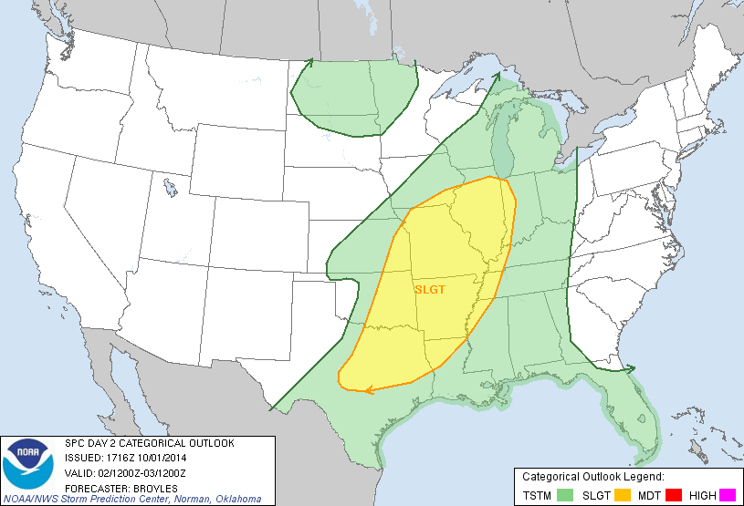
Risk of severe weather between 8 a.m. EDT Thursday and 8 a.m. EDT Friday. Yellow area: Slight risk. Green area: Thunderstorms forecast but none expected to be severe. Unshaded area: No thunderstorms forecast. Source: SPC “Day 2 Convective Outlook,” 1:16 p.m. EDT. Note: This is a cropped version of the original map, to highlight Indiana and Illinois. Other states to the south are also affected. View the full map.
Areas along the western edge of Indiana have a slight risk of severe weather between 8 a.m. EDT tomorrow and 8 a.m. EDT Friday, according the “Day 2 Convective Outlook” that the National Weather Service Storm Prediction Center (SPC) issued at 1:16 p.m. EDT. The slight risk area also includes most of Illinois and parts of several other nearby states to the west and south.
The greatest threat in the slight risk area is damaging straight-line thunderstorms winds of 58 mph or stronger, from a squall line that forecasters expect will develop tomorrow afternoon.
The SPC will update its outlook for tomorrow when it issues the first of several “Day 1 Convective Outlooks” at around 1 a.m.

 Extreme southern Indiana — along the banks of the Ohio River — has a slight risk of severe weather between 9 a.m. EDT today and 8 a.m. EDT tomorrow, according to the updated “Day 1 Convective Outlook” that the National Weather Service Storm Prediction Center issued at 8:28 a.m. EDT. Thunderstorms are forecast for the remainder of Indiana but forecasters expect none of those to be severe.
