

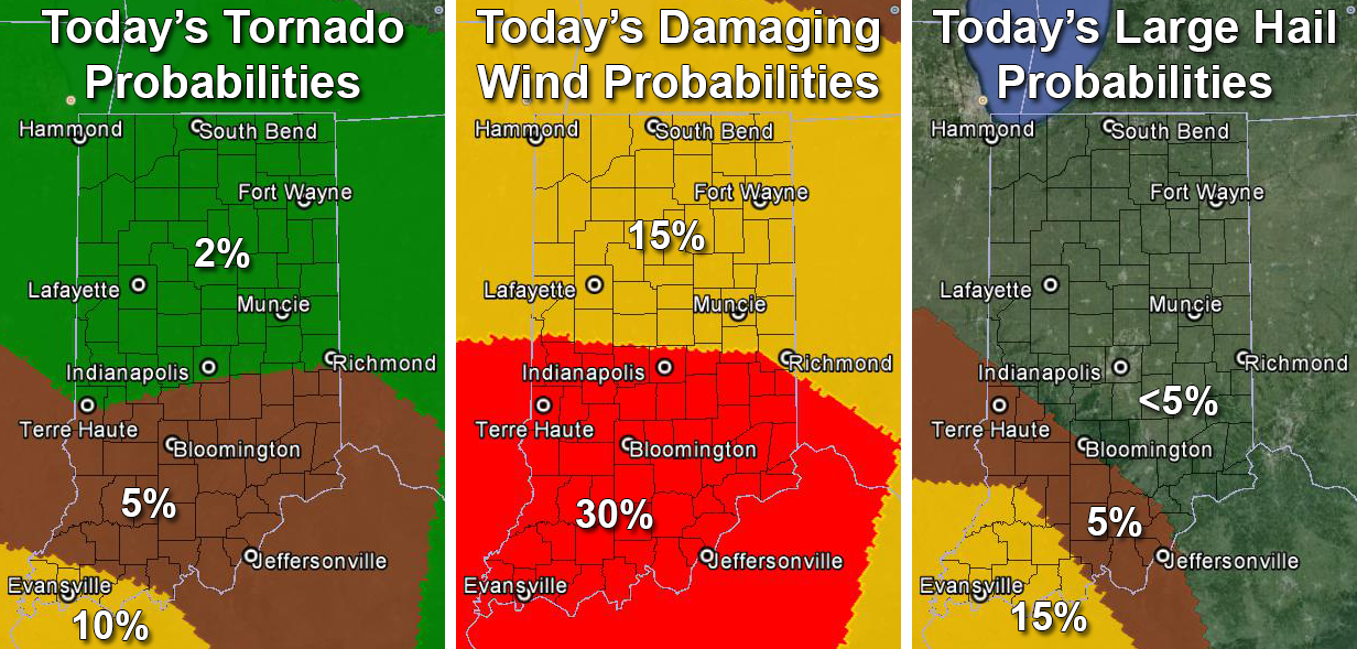
Probabilities of a tornado (left), damaging straight-line thunderstorm winds or gusts of 58 mph or greater (middle) or large hail of one inch or more in diameter (right) within 25 miles of any point between 8 a.m. EST today and 7 a.m. EST tomorrow. Source: SPC “Day 1 Convective Outlook” issued at 7:55 a.m. EST. Click image for larger view.
Indiana map showing probabilities of a tornado (left), damaging straight-line thunderstorm winds or gusts of 58 mph or greater (middle) or large hail of one inch or more in diameter (right) within 25 miles of any point between 8 a.m. EST Dec. 23, 2015 and 7 a.m. EST Dec. 24, 2015. Source: SPC “Day 1 Convective Outlook” issued at 7:55 a.m. EST Dec. 23.