

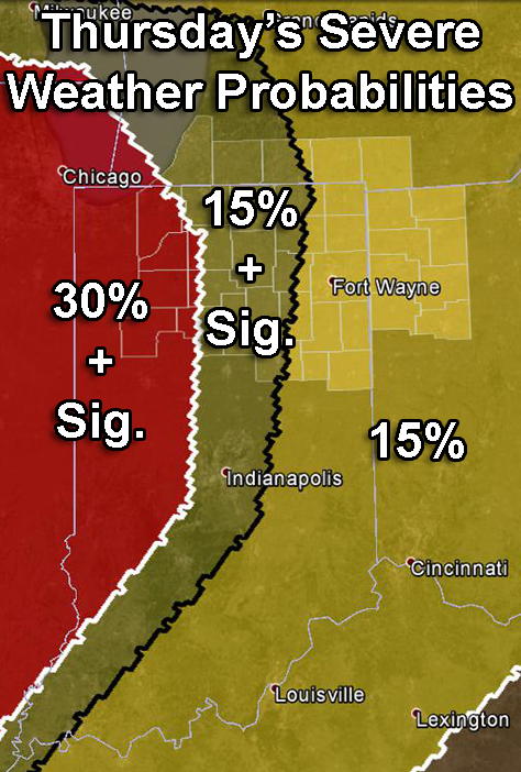
Probabilities of severe weather within 25 miles of any point between 8 a.m. Thurs. and 8 a.m. Fri. See definition of “sig.” in blog text. Highlighted counties: County warning area of the northern Indiana NWS office. Source: SPC “Day 2 Convective Outlook issued at 2 a.m. EDT