

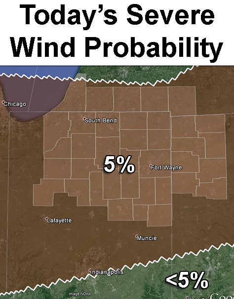
Probability of damaging straight-line severe thunderstorm winds with 25 miles of any point between 9 a.m. EDT today and 8 a.m. EDT tomorrow. Brown shading: 5%. Unshaded: Less than 5%. Highlighted counties: County warning area of the northern Indiana NWS office. Source: SPC “Day 1 Convective Outlook” issued at 8:56 a.m. EDT