

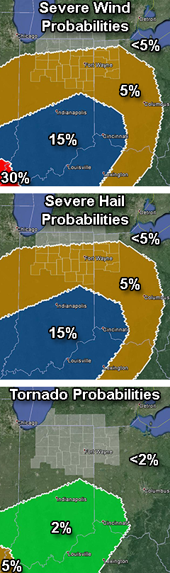
Probabilities of a tornado, damaging thunderstorm winds of 58 mph or stronger and hail of one inch or more in diameter within 25 miles of a point between 9 a.m. EDT today and 8 a.m. EDT Friday. Highlighted counties: County warning area of the northern Indiana NWS office. Source: SPC “Day 1 Convective Outlook” issued at 8 :59 a.m. EDT