

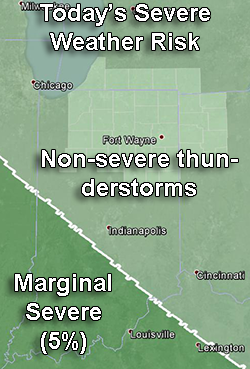
Risk of severe weather between 9 a.m. EDT today and 8 a.m. EDT tomorrow. Dark green shading: Marginal risk (5% probability). Light green: Thunderstorms, but none expected to be severe. Highlighted counties: County warning area of the northern Indiana NWS office. Source: SPC “Day 1 Convective Oultook” issued at 8:46 a.m. EDT