
The Fort Wayne / Allen County Health Department has some flood safety resources on this Web page.

The Fort Wayne / Allen County Health Department has some flood safety resources on this Web page.

From police scanner traffic, it sounds as if the Fort Wayne Fire Department is involved in some sort of operation along Spy Run Creek. One fire deparment officer just reported that the water in one intersection is at least 12 inches deeper than it was when he arrived. Add a comment below if you have additional information.
From the Fort Wayne Children’s Zoo’s Twitter feed:
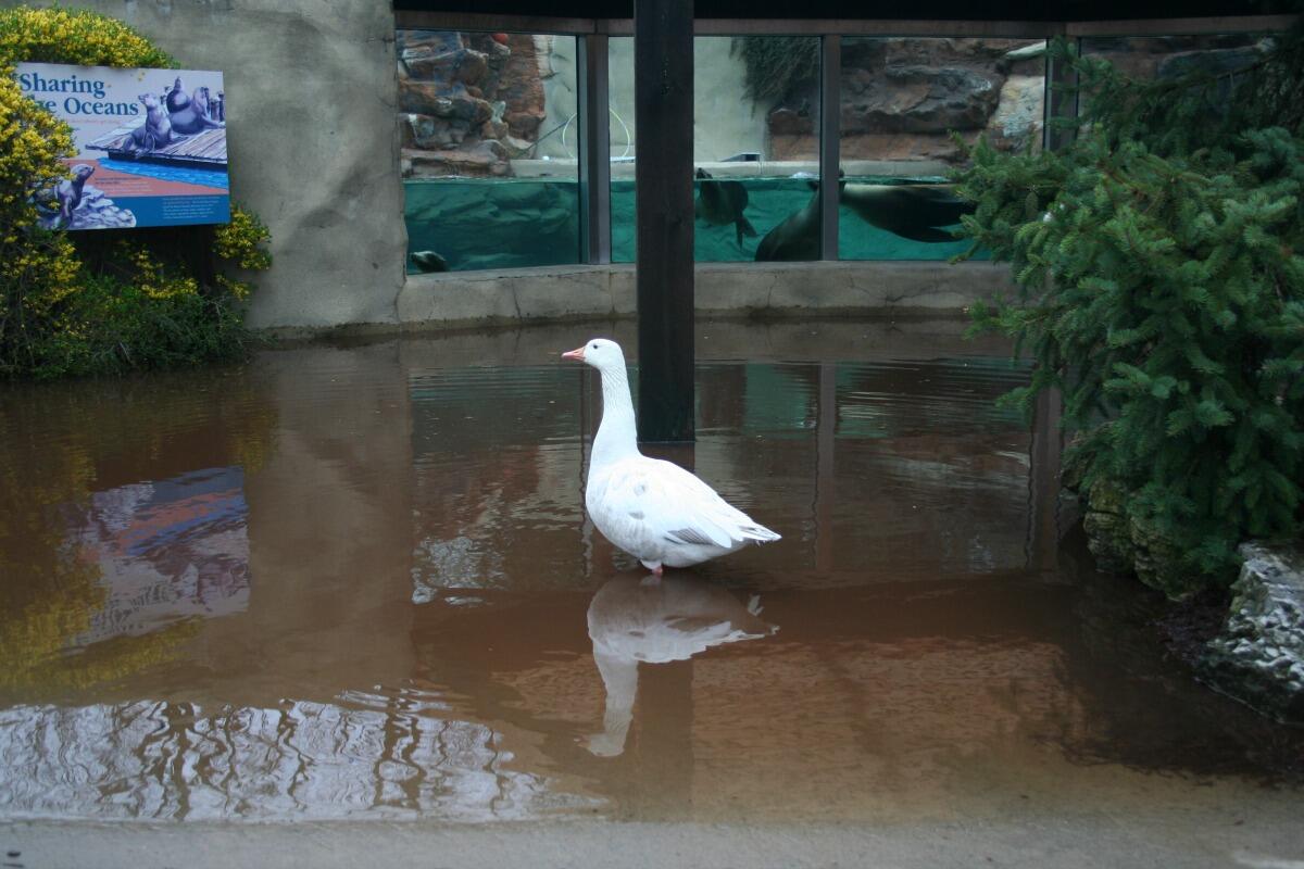 |
| Downside of heavy rains: minor flooding in zoo. Upside: Sea lions made new friends! |
Below are links to flood-related text products from the northern Indiana National Weather Service office. Each page lists every product the office has issued of that type, for any location in its 37-county warning area.
If you want to see only statements that affect Fort Wayne, visit this page and click the links in the pink “Hazardous Weather Conditions” box
WANE-TV’s website has a list of roads closed by flooding.
Want to know what various flood gauges around Fort Wayne are reading right now? Check out this interactive Web page.
The northern Indiana office of the NWS just pulled the trigger on a flood warning. The text includes:
NUMEROUS SMALL STREAMS AND CREEKS…INCLUDING SPY RUN IN THE FORT WAYNE METRO AREA…WILL LIKELY OVERFLOW THEIR BANKS. NUMEROUS ROADWAYS WILL BECOME IMPASSABLE DUE TO WATER FLOWING ACROSS THE ROAD…AND DEEP PONDED WATER IN POORLY DRAINED SECTIONS.
WANE TV meteorologist Jonathan Conder gives a good answer in his blog. Check it out.
The northern Indiana NWS office sent a tweet this evening asking people to report how much rain they’ve had. They’re asking people to be sure to include the amount, location, and the approximate time period. They’ll be looking for these reports on Twitter with the hash tag #nwsiwx.You can also post reports on the office’s Facebook page.
Earlier this evening, the NWS issued an urban and small stream flood advisory for several northeastern Indiana counties, including Allen County.
There’s also a flood watch in effect because “periods of heavy rainfall can be expected tonight. This heavy rainfall combined with already saturated soils and elevated river levels will likely lead to significant river flooding through the upcoming weekend.”
The tornado watch for areas south and southwest of Fort Wayne was canceled early. At the time of this writing, no tornado or severe thunderstorm watches were in effect anywhere in Indiana.