|
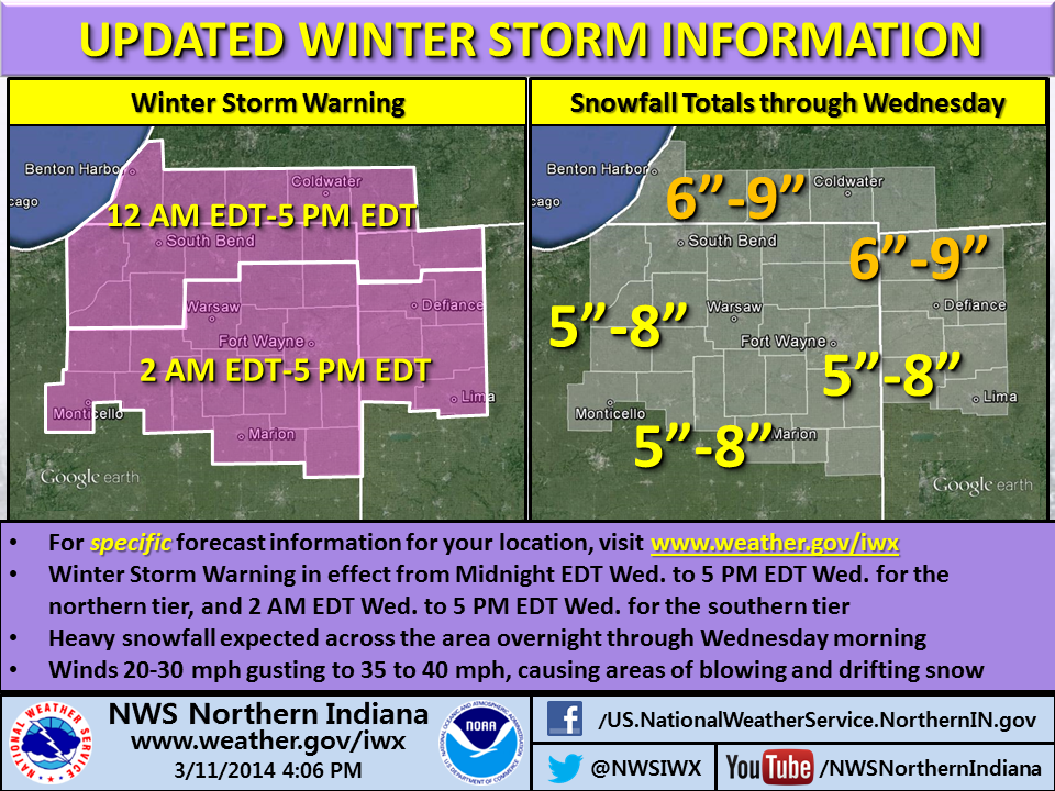
| Pink area indicates counties included in Winter Storm Warning (NWS map, 4 p.m. EDT March 11). |
Update: View a multimedia briefing on this storm.
The northern Indiana office of the National Weather Service has upgraded its previously-issued Winter Storm Watch for tonight and tomorrow to a Winter Storm Warning for its entire forecast area, including southeastern counties that the watch had excluded. The warning is in effect from 2 a.m. to 5 p.m. EDT tomorrow (Wednesday) for the southern part of the forecast area, including Allen County, Ind. It begins at 12:00 a.m. for northern counties (see graphic at bottom).
The warning forecasts five to eight inches of snow in southern parts of the 37-county forecast area and six to nine inches in northern counties. In addition, the NWS forecasts snowfall rates “in excess of an inch per hour” and winds of 20 mph to 30 mph gusting to 35 to 40 mph, causing “considerable blowing and drifting snow” and hazardous travel late tonight and Wednesday.The strong winds might also blow down tree branches and cause power outages.
See the latest verbatim statement from the NWS.
Why the change to a warning? The snowfall forecast increased for the warning area but what seems to have really helped meteorologists make the decision are the potential travel disruption from drifting snow and the potential power outages from high winds combined with heavy, wet snow.
The NWS infographic below shows meteorologists’ current thinking as to timing and accumulation. Free free to use the social media sharing buttons below the infographic to share this information with others. Also, feel free to use the comment facility to share your thoughts and/or questions.